SatPixel is an innovative platform designed to make geography learning engaging and intuitive through interactive satellite imagery games. It serves as a dynamic educational tool for students, teachers, travelers, and geo enthusiasts looking to deepen their understanding of the world from a unique perspective.
Key Features
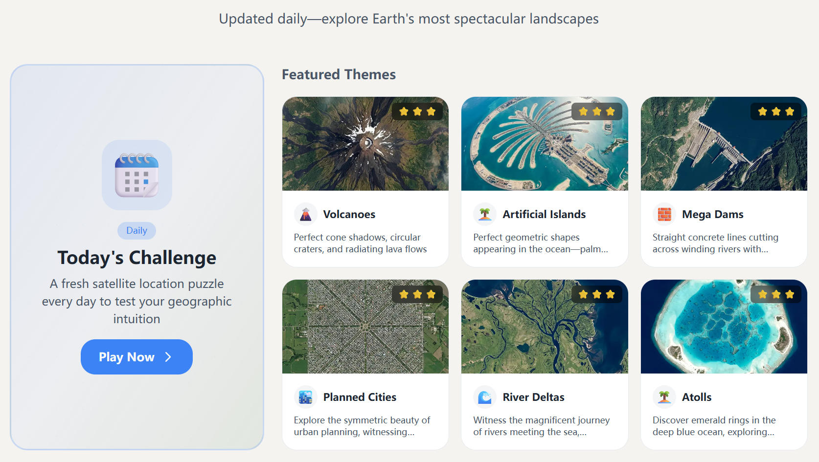
Authentic Satellite Data: Utilizes real-world imagery from Sentinel-2, Landsat, and other authoritative sources for genuine geo intuition.
Multilingual Interface: Supports Chinese, English, and Spanish UI, with city search accepting multiple languages for global accessibility.
Progressive Difficulty: Offers challenges ranging from major cities to specialist geo themes, suitable for all skill levels.
Gamified Learning: Builds spatial awareness and geo literacy through engaging game modes like SatZoom, SatPin, and SatQuiz.
Open and Transparent: Core features are free, require no login, and data sources are openly traceable for accuracy.
Device Optimized: Fully responsive design ensures seamless exploration on mobile, tablet, and desktop devices.
Use Cases
For Geography Teachers, SatPixel provides rich, classroom-ready materials to visualize abstract geographical concepts with real satellite imagery, significantly boosting student engagement. It offers interactive quizzes and real-world case studies that make learning dynamic and memorable.
Students and Learners benefit from a gamified practice environment that builds critical spatial thinking skills essential for exams, competitions, and travel preparation. The progressive difficulty and broad topical coverage ensure a comprehensive and enjoyable learning journey.
Travelers and Geo Fans can explore destinations from space, deepen their geographical knowledge, and broaden their global perspective. The platform allows users to browse stunning satellite imagery in the SatAtlas and improve their spatial sense through various challenges.
Pricing Information
SatPixel operates on a freemium model, with its core features being completely free to use without any registration required. Users can directly access satellite guessing games, quizzes, and the image atlas at no cost.
User Experience and Support
The platform is designed for ease of use, featuring an intuitive interface optimized for all devices, from smartphones to desktops. This ensures a consistent and accessible user experience anywhere. For any questions or suggestions, users can reach out via email through the About page, with community submissions for new questions also welcomed.
Technical Details
SatPixel sources its high-quality satellite imagery primarily from Sentinel-2 and Landsat. Geographic information is derived from OpenStreetMap and Wikipedia, ensuring open and traceable data for accuracy and educational value.
Pros and Cons
Pros: Authentic and traceable satellite data, supports multiple languages, offers progressive difficulty, promotes learning through play, free core features, fully mobile-friendly, excellent for classroom use.
Cons: No specific disadvantages or learning curves are highlighted in the provided content.
Conclusion
SatPixel offers a unique and effective way to explore the world and enhance geographical knowledge through interactive satellite imagery. Its blend of authentic data, gamified learning, and accessibility makes it an invaluable resource for anyone interested in geography. Start your exploration today and build true geo intuition!
Comments
Publisher

Sera
Launch Date2026-06-10
Platformweb
Pricingfree
Tech Stack
#game#satellite#map
Sponsors
TRAVDIGI - Reinventing Global Traveler Identity
Hotel check-in hasn't changed in 100 years. TravDigi changes that. Travelers verify once and check in anywhere with a QR scan in under 20 seconds. No paper forms. No queues. Free for travelers. 3 months free for hotels. 196 countries.
Aura++
All in one launch platform to launch your project and grow your online presence effortlessly.
Product Hunt Email Scraper
Scraper Email for Product Hunt Daily leaderboard and peerlist, tinylaunch, uneed.
Become a Sponsor
Get your brand featured here